
1901 Map of Globe
USGS Topo · Published 1955About this map
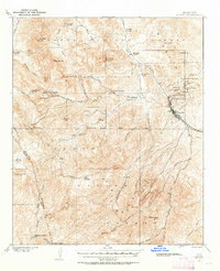
The copper mining district around Globe dominates this turn-of-the-century survey, revealing a landscape defined by heavy industry and early ranching. Concentrated along the northeastern quadrant, significant operations like the Old Dominion Mine, Copper Hill Mine, and Big Johnnie Mine reveal the scale of mineral extraction during the region's formative years. The G V G & N R R provides the vital rail link to these operations, snaking through the terrain to connect the town center with the surrounding pits and shafts.
Find a feature on this map
54 named features on this map. Tap any name to fly to it.
Don’t see what you’re looking for? This feature index may not catch every label — zoom into the map to look around manually.
Map Details
Editions of this 1901 Globe Map
2 editions found
Other maps of this area

1900 · Florence
USGS Topo · 1:125,000

1902 · Globe
USGS Topo · 1:62,500

1902 · Florence
USGS Topo · 1:125,000

1907 · Roosevelt
USGS Topo · 1:125,000

1909 · Four Peaks
USGS Topo · 1:125,000

1910 · Ray
USGS Topo · 1:62,500

1912 · Roosevelt
USGS Topo · 1:125,000

1915 · Christmas
USGS Topo · 1:62,500

1917 · Christmas
USGS Topo · 1:62,500

1922 · Chrysotile
USGS Topo · 1:125,000