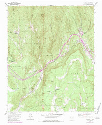
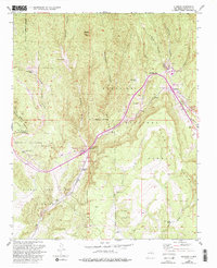
1953 Map of Glorieta
USGS Topo · Published 1983About this map
Glorieta Pass and the surrounding high-altitude terrain of the Santa Fe National Forest anchor this mid-century topographic record. The landscape is defined by the critical transport corridor of the Atchison Topeka and Santa Fe RR, which winds through Apache Canyon and passes through Cañoncito. Significant historical land divisions are evident through large tracts like the Bishop John Lamy Grant and the Cerros Negros de Sebastian Vargas Grant, reflecting the region's complex colonial and post-colonial heritage. Small family ranching outposts such as Romero Ranch, Garcia Ranch, and Gonzales Ranch dot the drainages of Galisteo Creek and Deer Creek, illustrating a resilient settlement pattern in the shadow of peaks like Shaggy Peak. The 1970s revisions, noted in purple, highlight the growth of the Glorieta Baptist Assembly and highway improvements near the pass.
Find a feature on this map
34 named features on this map. Tap any name to fly to it.
Don’t see what you’re looking for? This feature index may not catch every label — zoom into the map to look around manually.
Map Details
Editions of this 1953 Glorieta Map
6 editions found
Other maps of this area

1889 · Santa Fe
USGS Topo · 1:125,000

1894 · Santa Fe
USGS Topo · 1:125,000

1894 · Lamy
USGS Topo · 1:125,000

1952 · Santa Fe
USGS Topo · 1:24,000

1952 · Seton Village
USGS Topo · 1:24,000

1953 · Glorieta
USGS Topo · 1:24,000

1953 · Mc Clure Reservoir
USGS Topo · 1:24,000

1954 · Santa Fe
USGS Topo · 1:250,000

1958 · Santa Fe
USGS Topo · 1:250,000
1961 · Santa Fe
USGS Topo · 1:24,000