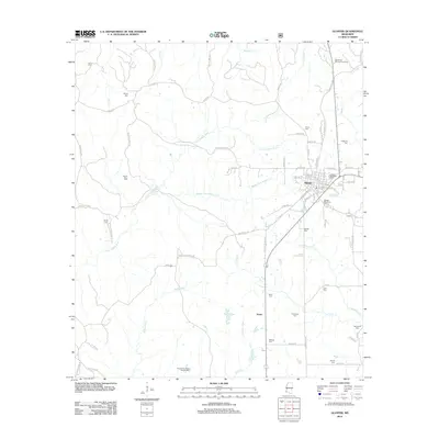
2012 Map of Gloster
USGS Topo · Published 2012About this map
Gloster serves as the primary hub in this southwest Mississippi landscape, defined by the winding paths of the Little Buffalo River and Middle Fork Buffalo Cr. The town's grid is dense with historical family landmarks, including Gloster Roselawn Cem and Gloster Woodlawn Cem, indicating a long-established community center. To the south, the smaller settlement of Tatum sits along the Georgia Pacific No 2 rail line, highlighting the area's industrial ties to timber and transportation.
Find a feature on this map
79 named features on this map. Tap any name to fly to it.
Don’t see what you’re looking for? This feature index may not catch every label — zoom into the map to look around manually.
Map Details
Editions of this 2012 Gloster Map
This is the sole edition of this map. No revisions or reprints were ever made.
Other maps of this area

1953 · Natchez
USGS Topo · 1:250,000

1956 · Natchez
USGS Topo · 1:250,000

1959 · Natchez
USGS Topo · 1:250,000

1961 · Liberty
USGS Topo · 1:62,500

1961 · Crosby
USGS Topo · 1:62,500

1961 · Gloster
USGS Topo · 1:62,500

1962 · Bude
USGS Topo · 1:62,500

1984 · McComb
USGS Topo · 1:100,000

1984 · Woodville
USGS Topo · 1:100,000
1988 · Homochitto
USGS Topo · 1:24,000