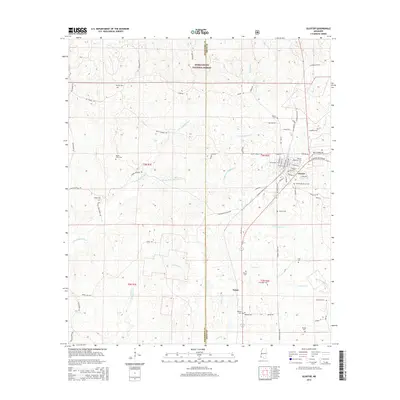
2015 Map of Gloster
USGS Topo · Published 2015About this map
The town of Gloster serves as the primary hub of this area on the Wilkinson and Amite County line, characterized by a grid of streets including Charles St and Sterling Rd. To the south, the settlement of Tatum sits near the winding paths of Tatum Cr and Smith Cr. The landscape is defined by the headwaters and tributaries of the Buffalo River, which meanders through a mix of timberlands and rural homesteads. Significant portions of the northern section are protected within the Homochitto National Forest. Genealogists will find a high density of burial sites throughout the quadrangle, from the larger Gloster Roselawn Cem and Gloster Woodlawn Cem in town to smaller family and community grounds like Haynes Cem, Lusk Cem, and Damascus Cem. Industrial presence is noted by the Georgia Pacific No 2 St, reflecting the region's long-standing connection to the forestry industry.
Find a feature on this map
79 named features on this map. Tap any name to fly to it.
Don’t see what you’re looking for? This feature index may not catch every label — zoom into the map to look around manually.
Map Details
Editions of this 2015 Gloster Map
This is the sole edition of this map. No revisions or reprints were ever made.
Other maps of this area
1953 · Natchez
USGS Topo · 1:250,000
1956 · Natchez
USGS Topo · 1:250,000
1959 · Natchez
USGS Topo · 1:250,000
1961 · Liberty
USGS Topo · 1:62,500
1961 · Crosby
USGS Topo · 1:62,500
1961 · Gloster
USGS Topo · 1:62,500
1962 · Bude
USGS Topo · 1:62,500
1984 · McComb
USGS Topo · 1:100,000
1984 · Woodville
USGS Topo · 1:100,000
1988 · Homochitto
USGS Topo · 1:24,000