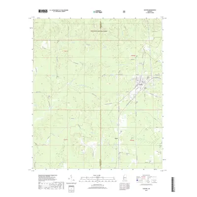
2018 Map of Gloster
USGS Topo · Published 2018About this map
Gloster serves as the primary hub in this southwestern Mississippi landscape, situated at the intersection of S Captain Gloster Dr and E Main St. The town is noted for its concentration of historic sites, including Harper College and several burial grounds such as Gloster Roselawn Cem and Gloster Woodlawn Cem. To the north, the terrain transitions into the protected woodlands of the Homochitto National Forest, where smaller drainages like Cypress Cr and Foster Cr feed into the larger river systems.
Find a feature on this map
72 named features on this map. Tap any name to fly to it.
Don’t see what you’re looking for? This feature index may not catch every label — zoom into the map to look around manually.
Map Details
Editions of this 2018 Gloster Map
This is the sole edition of this map. No revisions or reprints were ever made.
Other maps of this area
1953 · Natchez
USGS Topo · 1:250,000
1956 · Natchez
USGS Topo · 1:250,000
1959 · Natchez
USGS Topo · 1:250,000
1961 · Liberty
USGS Topo · 1:62,500
1961 · Crosby
USGS Topo · 1:62,500
1961 · Gloster
USGS Topo · 1:62,500
1962 · Bude
USGS Topo · 1:62,500
1984 · McComb
USGS Topo · 1:100,000
1984 · Woodville
USGS Topo · 1:100,000
1988 · Homochitto
USGS Topo · 1:24,000