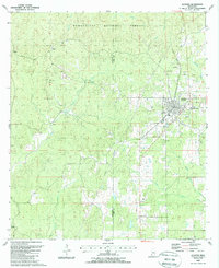
1988 Map of Gloster
USGS Topo · Published 1988About this map
The Illinois Central Gulf Railroad anchors the community of Gloster, which serves as a significant hub near the Wilkinson and Amite county line. The town's infrastructure in the late 1980s includes a localized grid of streets, a High School, and the Pine Hills Academy. To the north, the protected woodlands of the Homochitto National Forest dominate the terrain, intersected by several watercourses including Cypress Creek, Redding Creek, and the Buffalo River.
Find a feature on this map
30 named features on this map. Tap any name to fly to it.
Don’t see what you’re looking for? This feature index may not catch every label — zoom into the map to look around manually.
Map Details
Editions of this 1988 Gloster Map
This is the sole edition of this map. No revisions or reprints were ever made.
Other maps of this area

1953 · Natchez
USGS Topo · 1:250,000

1956 · Natchez
USGS Topo · 1:250,000

1959 · Natchez
USGS Topo · 1:250,000

1961 · Liberty
USGS Topo · 1:62,500

1961 · Crosby
USGS Topo · 1:62,500

1961 · Gloster
USGS Topo · 1:62,500

1962 · Bude
USGS Topo · 1:62,500

1984 · McComb
USGS Topo · 1:100,000

1984 · Woodville
USGS Topo · 1:100,000
1988 · Homochitto
USGS Topo · 1:24,000