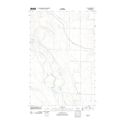
2011 Map of Gloyd
USGS Topo · Published 2011About this map
Gloyd sits at the heart of this agricultural and water-management landscape in Grant County, where the desert environment has been transformed by irrigation infrastructure. The map documents a complex network of man-made and natural water features, including the winding path of Crab Creek and the pooled waters of Lake Lyon and Glyn Lake. These reservoirs are controlled by specific engineering landmarks like the Lyon Lake Dam and Glyn Dam, illustrating the vital role of water storage for local farming. The arrival of water is further evidenced by the Ne Low Canal Rd and East Low Canal Rd Ne, which follow the life-giving arteries of the regional canal system. High-elevation points like Willow Lake punctuate the northern terrain, while a rigid grid of rural roads, such as Road 14 Ne and Stratford Rd, organizes the surrounding homesteads and fields.
Find a feature on this map
24 named features on this map. Tap any name to fly to it.
Don’t see what you’re looking for? This feature index may not catch every label — zoom into the map to look around manually.
Map Details
Editions of this 2011 Gloyd Map
This is the sole edition of this map. No revisions or reprints were ever made.
Other maps of this area

1912 · Moses Lake
USGS Topo · 1:62,500

1923 · Wheeler
USGS Topo · 1:62,500

1925 · Wheeler
USGS Topo · 1:62,500

1953 · Ritzville
USGS Topo · 1:250,000

1956 · Wheeler
USGS Topo · 1:24,000

1956 · Stratford
USGS Topo · 1:24,000

1956 · Grant Orchards
USGS Topo · 1:24,000

1956 · Moses Lake North
USGS Topo · 1:24,000

1956 · Gloyd
USGS Topo · 1:24,000

1956 · Wilson Creek SW
USGS Topo · 1:24,000