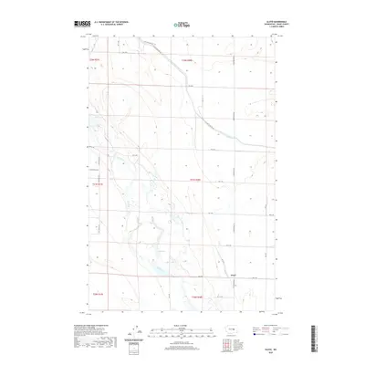
2020 Map of Gloyd
USGS Topo · Published 2020About this map
Gloyd sits at a crossroads of agriculture and hydrology in this high-desert landscape of central Washington. The engineered path of the East Low Canal cuts diagonally across the northern terrain, illustrating the sophisticated irrigation infrastructure necessary for the region's farming economy. Natural water features like Crab Creek wind through the center of the map, creating a chain of wetlands and water bodies including Lake Lyon, Glyn Lake, and Willow Lake. The rural road network, defined by routes such as Stratford Rd NE and Eastside Dr Ne, follows the rigid Public Land Survey System grid, partitioning the land into townships like t21n r28e and t22n r28e. This layout reveals the intersection of modern logistics and the natural drainage patterns of the Columbia Basin.
Find a feature on this map
28 named features on this map. Tap any name to fly to it.
Don’t see what you’re looking for? This feature index may not catch every label — zoom into the map to look around manually.
Map Details
Editions of this 2020 Gloyd Map
This is the sole edition of this map. No revisions or reprints were ever made.
Other maps of this area

1912 · Moses Lake
USGS Topo · 1:62,500

1923 · Wheeler
USGS Topo · 1:62,500

1925 · Wheeler
USGS Topo · 1:62,500

1953 · Ritzville
USGS Topo · 1:250,000

1956 · Wheeler
USGS Topo · 1:24,000

1956 · Stratford
USGS Topo · 1:24,000

1956 · Grant Orchards
USGS Topo · 1:24,000

1956 · Moses Lake North
USGS Topo · 1:24,000

1956 · Gloyd
USGS Topo · 1:24,000

1956 · Wilson Creek SW
USGS Topo · 1:24,000