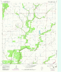
1965 Map of Gobbler Creek
USGS Topo · Published 1983About this map
Round Mott and Brama anchor the rural landscape of this coastal prairie region near the Wharton and Jackson county line. The terrain is defined by a dense network of slow-moving watercourses, including Gobbler Creek, West Mustang Creek, and the winding Chaco Slough. By the mid-1960s, the area was heavily marked by the energy industry, with numerous wells, gas wells, and oil wells scattered among the cattle range and fenced fields.
Find a feature on this map
22 named features on this map. Tap any name to fly to it.
Don’t see what you’re looking for? This feature index may not catch every label — zoom into the map to look around manually.
Map Details
Editions of this 1965 Gobbler Creek Map
2 editions found
Other maps of this area

1953 · Seguin
USGS Topo · 1:250,000

1958 · Seguin
USGS Topo · 1:250,000

1960 · New Taiton
USGS Topo · 1:24,000

1963 · Ganado
USGS Topo · 1:24,000

1965 · El Campo
USGS Topo · 1:24,000

1965 · Ganado NE
USGS Topo · 1:24,000

1965 · Sheridan SE
USGS Topo · 1:24,000

1965 · Gobbler Creek
USGS Topo · 1:24,000
1965 · El Campo SE
USGS Topo · 1:24,000
1965 · Hahn
USGS Topo · 1:24,000