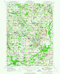
1948 Map of Gobles
USGS Topo · Published 1964About this map
Gobles and Bloomingdale anchor this 1948 survey of Van Buren County, showing a landscape defined by a dense network of rural school districts and small agricultural hubs. The New York Central railroad provides the primary industrial spine, connecting the settlements of Berlamont, Kendall, and Mentha across the glacial till. In the southern portion of the map, the Wolf Lake Fish Hatchery and adjacent Rearing Ponds indicate early state conservation efforts. The terrain is dotted with small kettle lakes like Great Bear Lake and Swan Lake, many of which supported localized settlements or recreation. The abundance of namesake landmarks, such as Covey Hill Ch and Armstrong Corners, offers a detailed look at the 1940s township structure before the consolidation of rural services, preserving the locations of numerous country schools like Old Pine Grove Sch and Healy Sch.
Find a feature on this map
138 named features on this map. Tap any name to fly to it.
Don’t see what you’re looking for? This feature index may not catch every label — zoom into the map to look around manually.
Map Details
Editions of this 1948 Gobles Map
3 editions found

Other maps of this area

1916 · Kalamazoo
USGS Topo · 1:62,500

1918 · Kalamazoo
USGS Topo · 1:62,500

1922 · Schoolcraft
USGS Topo · 1:62,500

1927 · Hartford
USGS Topo · 1:62,500

1927 · Bangor
USGS Topo · 1:62,500

1928 · Fennville
USGS Topo · 1:62,500

1931 · Fennville
USGS Topo · 1:62,500

1931 · Bangor
USGS Topo · 1:62,500

1931 · Hartford
USGS Topo · 1:62,500

1943 · Kalamazoo
USGS Topo · 1:62,500