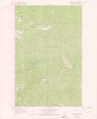
1964 Map of Goddards Peak
USGS Topo · Published 1975About this map
Goddards Peak and the high ridges of the Colville National Forest dominate this mid-century survey of the Selkirk Mountains. The landscape is defined by its steep terrain and drainage systems, including the South Fork Chewelah Creek and the North Fork Calispell Creek. Evidence of early activity in the high country is marked by the Calispell Ruins and a Lookout Tower atop Chewelah Mtn. Numerous high-elevation openings like Healey Meadow, Dahlstrom Meadow, and Bisbee Meadow are named alongside family-associated landmarks such as Wilson Mtn and Johnson Mtn. Transportation through the forest relies on a network of unpaved routes, including the Flowery Trail Road, Upper Cottonwood Road, and various unnamed jeep trails that provide access to remote waters like Horseshoe Lake and Johnson Lake.
Find a feature on this map
33 named features on this map. Tap any name to fly to it.
Don’t see what you’re looking for? This feature index may not catch every label — zoom into the map to look around manually.
Map Details
Editions of this 1964 Goddards Peak Map
4 editions found
Other maps of this area

1927 · Chewelah
USGS Topo · 1:125,000

1930 · Chewelah
USGS Topo · 1:125,000

1936 · Newport
USGS Topo · 1:96,000

1942 · Newport
USGS Topo · 1:125,000

1958 · Sandpoint
USGS Topo · 1:250,000

1963 · Sandpoint
USGS Topo · 1:250,000

1964 · Chewelah
USGS Topo · 1:24,000

1964 · Cliff Ridge
USGS Topo · 1:24,000
1964 · Calispell Peak
USGS Topo · 1:24,000

1964 · Goddards Peak
USGS Topo · 1:24,000