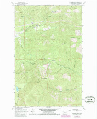
1964 Map of Goddards Peak
USGS Topo · Published 1986About this map
Goddards Peak rises as a central landmark within the high country of Stevens County, where the Colville National Forest and Kaniksu National Forest meet. This mid-1960s survey, updated with 1980s data, illustrates a transition from traditional forest management to recreational development, most notably at the 49 North Ski Area with its documented ski lifts. The landscape is dotted with family-named clearings and water sources such as Bisbee Meadow, McPherson Spring, and Johnson Lake. A lookout tower on Chewelah Mtn stands above the headwaters of numerous drainages, including the South Fork Chewelah Creek and Little Calispell Creek, highlighting the importance of fire surveillance in these heavily timbered mountains.
Find a feature on this map
41 named features on this map. Tap any name to fly to it.
Don’t see what you’re looking for? This feature index may not catch every label — zoom into the map to look around manually.
Map Details
Editions of this 1964 Goddards Peak Map
4 editions found
Other maps of this area

1927 · Chewelah
USGS Topo · 1:125,000

1930 · Chewelah
USGS Topo · 1:125,000

1936 · Newport
USGS Topo · 1:96,000

1942 · Newport
USGS Topo · 1:125,000

1958 · Sandpoint
USGS Topo · 1:250,000

1963 · Sandpoint
USGS Topo · 1:250,000

1964 · Chewelah
USGS Topo · 1:24,000

1964 · Cliff Ridge
USGS Topo · 1:24,000
1964 · Calispell Peak
USGS Topo · 1:24,000

1964 · Goddards Peak
USGS Topo · 1:24,000