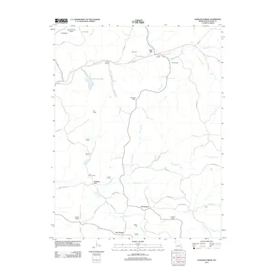
2012 Map of Goerlisch Ridge
USGS Topo · Published 2012About this map
Old Woollam and New Woollam anchor this rural landscape in Gasconade County, where the terrain is defined by a series of prominent ridges and creek drainage systems. The northern boundary is marked by the Gasconade River, featuring landmarks such as Pin Oak Bluff and Kings Lookout. A significant concentration of family and community cemeteries, including Atkins Cemetery, Laubert Cemetery, and Jenkins Cemetery, suggests a long-settled agricultural heritage.
Find a feature on this map
56 named features on this map. Tap any name to fly to it.
Don’t see what you’re looking for? This feature index may not catch every label — zoom into the map to look around manually.
Map Details
Editions of this 2012 Goerlisch Ridge Map
This is the sole edition of this map. No revisions or reprints were ever made.
Other maps of this area

1890 · Hermann
USGS Topo · 1:125,000

1890 · Fulton
USGS Topo · 1:125,000

1903 · Sullivan
USGS Topo · 1:125,000

1934 · Bland
USGS Topo · 1:62,500

1935 · Gerald
USGS Topo · 1:48,000

1935 · Morrison
USGS Topo · 1:48,000

1936 · Hermann
USGS Topo · 1:48,000

1937 · Bland
USGS Topo · 1:62,500

1941 · Gerald
USGS Topo · 1:62,500

1942 · Morrison
USGS Topo · 1:62,500