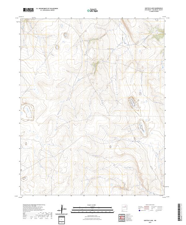
2023 Map of Goetsch Lake
USGS Topo · Published 2023About this map
Tipton Creek winds through this section of San Miguel County, carving a drainage pattern that eventually meets the Conchas River to the south. This 2023 survey by the U.S. Geological Survey captures a sparsely populated landscape defined by ranch roads and natural hydrology. The map's namesake, Goetsch Lake, sits in the eastern half of the quadrangle, accessible by the aptly named Goetsch Ln. The road network is limited to rural connectors such as Lynan Canyon Rd, Canter Rd, and S Range Rd, reflecting the open range and topographic character typical of this high-desert environment. The detail is particularly useful for modern land-use studies, showing the precise relationship between seasonal watercourses and local ranching access points.
Find a feature on this map
8 named features on this map. Tap any name to fly to it.
Don’t see what you’re looking for? This feature index may not catch every label — zoom into the map to look around manually.
Map Details
Editions of this 2023 Goetsch Lake Map
This is the sole edition of this map. No revisions or reprints were ever made.
Other maps of this area

1889 · Las Vegas
USGS Topo · 1:125,000

1891 · Las Vegas
USGS Topo · 1:125,000

1892 · Watrous
USGS Topo · 1:125,000

1893 · Las Vegas
USGS Topo · 1:125,000

1894 · Watrous
USGS Topo · 1:125,000

1954 · Santa Fe
USGS Topo · 1:250,000

1958 · Santa Fe
USGS Topo · 1:250,000
1963 · Las Vegas SE
USGS Topo · 1:24,000
1963 · Loma Parda
USGS Topo · 1:24,000
1963 · Onava
USGS Topo · 1:24,000