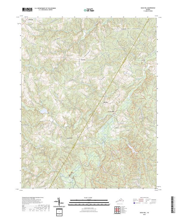
2022 Map of Gold Hill
USGS Topo · Published 2022About this map
The Buckingham Co and Cumberland Co line bisects this landscape, marking a rural territory where small crossroads communities and family-named landmarks define the geography. Gold Hill and Union Hill stand as principal reference points along a network of historic routes like Petersville Church Rd and Trents Mill Rd. The map reveals a land shaped by its hydrography, with the Willis River winding through the eastern portion and numerous smaller tributaries like Buck and Game Cr and Halfway Cr carving through the terrain.
Find a feature on this map
73 named features on this map. Tap any name to fly to it.
Don’t see what you’re looking for? This feature index may not catch every label — zoom into the map to look around manually.
Map Details
Editions of this 2022 Gold Hill Map
This is the sole edition of this map. No revisions or reprints were ever made.
Other maps of this area

1891 · Palmyra
USGS Topo · 1:125,000

1891 · Farmville
USGS Topo · 1:125,000

1893 · Farmville
USGS Topo · 1:125,000

1895 · Palmyra
USGS Topo · 1:125,000

1897 · Palmyra
USGS Topo · 1:125,000

1947 · Roanoke
USGS Topo · 1:250,000

1950 · Dillwyn
USGS Topo · 1:62,500

1958 · Farmville
USGS Topo · 1:62,500

1958 · Jetersville
USGS Topo · 1:62,500

1958 · Dillwyn
USGS Topo · 1:62,500