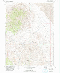
1973 Map of Gold Hill
USGS Topo · Published 1993About this map
Dutch Mountain and its surrounding peaks dominate this 1973 survey of a productive mining district in Tooele County. The settlement of Gold Hill is situated amidst a landscape heavily marked by extraction, with numerous workings such as the Alvarado Mine, Stardust Mine, and Garrison Mines scattered across the high terrain. The density of named prospects and mines reflects an era of intense geological exploration and resource development in the Great Basin.
Find a feature on this map
28 named features on this map. Tap any name to fly to it.
Don’t see what you’re looking for? This feature index may not catch every label — zoom into the map to look around manually.
Map Details
Editions of this 1973 Gold Hill Map
2 editions found
Other maps of this area

1925 · Gold Hill
USGS Topo · 1:62,500

1928 · Gold Hill
USGS Topo · 1:62,500

1953 · Tooele
USGS Topo · 1:250,000

1955 · Tooele
USGS Topo · 1:250,000

1972 · Elephant Knoll
USGS Topo · 1:24,000

1972 · Elephant Knoll SE
USGS Topo · 1:24,000
1973 · Ochre Mountain
USGS Topo · 1:24,000
1973 · Gold Hill
USGS Topo · 1:24,000
1973 · Ibapah
USGS Topo · 1:24,000

1973 · Gold Hill 1 SW
USGS Topo · 1:24,000