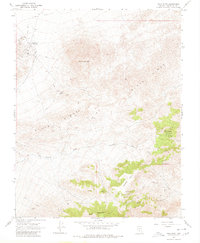
1968 Map of Gold Point
USGS Topo · Published 1979About this map
Gold Point serves as the primary hub of activity in this 1968 desert survey, situated at the edge of the Lida Valley. The landscape is dominated by the massive presence of Slate Ridge and Mount Dunfee, terrain that supported a significant mining economy. Numerous shafts and operations are documented throughout the high ground, including the Dunfee Shaft, the Empress Mine, and the Tokop site near a prominent Radio Tower.
Find a feature on this map
29 named features on this map. Tap any name to fly to it.
Don’t see what you’re looking for? This feature index may not catch every label — zoom into the map to look around manually.
Map Details
Editions of this 1968 Gold Point Map
2 editions found
Other maps of this area

1908 · Lida
USGS Topo · 1:250,000

1913 · Lida
USGS Topo · 1:250,000

1954 · Goldfield
USGS Topo · 1:250,000

1955 · Goldfield
USGS Topo · 1:250,000

1957 · Ubehebe Crater
USGS Topo · 1:62,500

1958 · Goldfield
USGS Topo · 1:250,000

1962 · Goldfield
USGS Topo · 1:250,000

1968 · Lida
USGS Topo · 1:24,000

1968 · Stonewall Pass
USGS Topo · 1:24,000
1968 · Gold Point SW
USGS Topo · 1:24,000