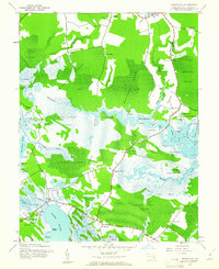
1942 Map of Golden Hill
USGS Topo · Published 1961About this map
The Honga River and its intricate network of tidal guts and marshes dominate this 1942 survey of Dorchester County. The landscape is a complex weave of water and wooded necks, where small settlements like Golden Hill and Harrisville occupy the slightly higher ground. This era shows the extensive bounds of the Blackwater National Wildlife Refuge protecting the vast wetlands of Moneystump Swamp and Russell Swamp.
Find a feature on this map
71 named features on this map. Tap any name to fly to it.
Don’t see what you’re looking for? This feature index may not catch every label — zoom into the map to look around manually.
Map Details
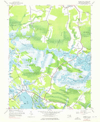
Editions of this 1942 Golden Hill Map
2 editions found
Other maps of this area

1892 · Drum Point
USGS Topo · 1:62,500

1893 · Sharps Island
USGS Topo · 1:62,500

1898 · Choptank
USGS Topo · 1:125,000

1898 · St. Marys
USGS Topo · 1:125,000

1901 · Drum Point
USGS Topo · 1:62,500

1904 · Sharps Island
USGS Topo · 1:62,500

1904 · Oxford
USGS Topo · 1:62,500

1905 · Crapo
USGS Topo · 1:62,500

1905 · Drum Point
USGS Topo · 1:62,500

1906 · St. Marys
USGS Topo · 1:125,000