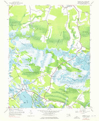
1942 Map of Golden Hill
USGS Topo · Published 1976About this map
The vast wetlands of the Blackwater National Wildlife Refuge dominate this 1942 landscape, where the Blackwater River and Honga River define the intricate shoreline of Dorchester County. Small crossroads communities and family-named landings like Golden Hill, Milton, and Walnut Landing are scattered throughout the marshy terrain, connected by narrow roads winding between Peters Neck and Buttons Neck. This survey reflects the region's historical reliance on the water, showing numerous guts and creeks such as Piney Gut and Meekins Creek that served as local transportation arteries. Notable interior landmarks include the Lookout Tower near Hog Range and the isolated settlement at Old Field. The map provides a detailed view of the extensive swamp systems, including Moneystump Swamp and White Oak Swamp, which have historically shaped the settlement patterns and agricultural limits of the Maryland Eastern Shore.
Find a feature on this map
79 named features on this map. Tap any name to fly to it.
Don’t see what you’re looking for? This feature index may not catch every label — zoom into the map to look around manually.
Map Details
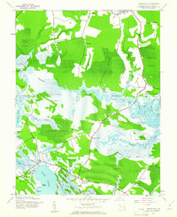
Editions of this 1942 Golden Hill Map
2 editions found
Other maps of this area

1892 · Drum Point
USGS Topo · 1:62,500

1893 · Sharps Island
USGS Topo · 1:62,500

1898 · Choptank
USGS Topo · 1:125,000

1898 · St. Marys
USGS Topo · 1:125,000

1901 · Drum Point
USGS Topo · 1:62,500

1904 · Sharps Island
USGS Topo · 1:62,500

1904 · Oxford
USGS Topo · 1:62,500

1905 · Crapo
USGS Topo · 1:62,500

1905 · Drum Point
USGS Topo · 1:62,500

1906 · St. Marys
USGS Topo · 1:125,000