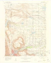
1957 Map of Golden
USGS Topo · Published 1958About this map
Golden serves as the industrial and academic anchor of this mid-century landscape, dominated by the sprawling Colorado School of Mines and the military grounds of Camp George West. The terrain is defined by the massive basalt caps of North Table Mountain and South Table Mountain, which forced early transit corridors and water infrastructure to follow the natural relief. To the north, the small settlement of Leyden and the nearby Leyden Junction sit along the Denver and Rio Grande Western railroad, highlighting the area's history of coal mining and clay extraction, evidenced by various clay pits along the ridges. The eastern plains transition into a developing suburban grid, where established community landmarks like Mount Olivet Cemetery and the Enterprise Grange provided social and spiritual structure for Jefferson County residents.
Find a feature on this map
53 named features on this map. Tap any name to fly to it.
Don’t see what you’re looking for? This feature index may not catch every label — zoom into the map to look around manually.
Map Details
Editions of this 1957 Golden Map
3 editions found
Other maps of this area

1899 · West Denver
USGS Topo · 1:125,000

1906 · Blackhawk
USGS Topo · 1:62,500

1938 · Morrison
USGS Topo · 1:24,000

1939 · Golden
USGS Topo · 1:24,000

1940 · Lafayette
USGS Topo · 1:31,680

1941 · Arvada
USGS Topo · 1:31,680

1941 · Fort Logan
USGS Topo · 1:31,680

1942 · Eldorado Springs
USGS Topo · 1:24,000

1942 · Morrison
USGS Topo · 1:31,680

1942 · Golden
USGS Topo · 1:31,680