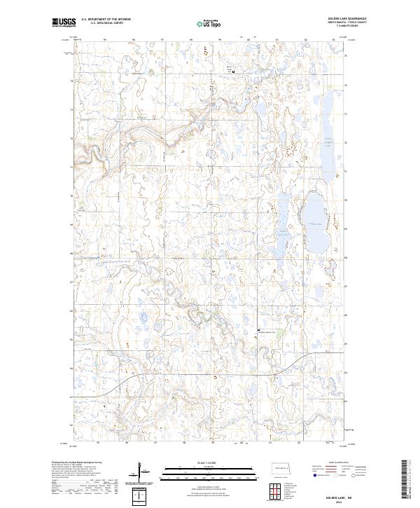
2024 Map of Golden Lake
USGS Topo · Published 2024About this map
Golden Lake and the surrounding wetland complexes of Steele County define this prairie landscape, where water management and conservation efforts are central to the terrain. The presence of the Steele County Waterfowl Production Area across several sections highlights the region's importance for migratory birds and local conservation. Historically significant sites for family researchers are preserved here, including the Beaver Creek Cem in the north and the Bethany Lutheran Cem further south near the Middle Branch Goose River. The map shows a transition from the drainage of Beaver Creek to the larger basin of North Golden Lake and Golden Rush Lake, reflecting a glacial topography of depressions and rises common in this part of North Dakota. This modern survey provides a clear view of the rural road network, from section-line paths like 135th Ave NE to established routes such as Co Hwy 23.
Find a feature on this map
29 named features on this map. Tap any name to fly to it.
Don’t see what you’re looking for? This feature index may not catch every label — zoom into the map to look around manually.
Map Details
Editions of this 2024 Golden Lake Map
This is the sole edition of this map. No revisions or reprints were ever made.
Other maps of this area

1952 · Grand Forks
USGS Topo · 1:250,000

1956 · Grand Forks
USGS Topo · 1:250,000

1966 · Grand Forks
USGS Topo · 1:250,000

1967 · Finley NE
USGS Topo · 1:24,000

1967 · Blabon
USGS Topo · 1:24,000

1967 · Finley
USGS Topo · 1:24,000

1968 · Hope NE
USGS Topo · 1:24,000

1968 · Sherbrooke
USGS Topo · 1:24,000
1970 · Northwood SE
USGS Topo · 1:24,000
1970 · Northwood NW
USGS Topo · 1:24,000
Featured Places
- Finley Township, ND
- Golden Lake Township, ND
- Beaver Creek Township, ND
- Westfield Township, ND
- Steele County, ND