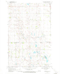
1970 Map of Northwood NW
USGS Topo · Published 1972About this map
Lake Tobiason and the surrounding drainage of Beaver Creek anchor this rural landscape along the boundary of Grand Forks and Steele counties. The survey shows a highly structured agricultural grid, where small family-named landmarks and community hubs provide the primary navigational markers. In the township of Lind, Bethania Ch and the Herickson Cem stand as early social anchors for the surrounding farmsteads. To the south, the Farmers Union Recreation Area on the shores of Lake Tobiason suggests the local importance of the water body for more than just drainage. The presence of multiple Townhall locations and the Hanson Cem reflect the decentralized nature of local governance and social life in this portion of North Dakota during the early 1970s.
Find a feature on this map
15 named features on this map. Tap any name to fly to it.
Don’t see what you’re looking for? This feature index may not catch every label — zoom into the map to look around manually.
Map Details
Editions of this 1970 Northwood NW Map
This is the sole edition of this map. No revisions or reprints were ever made.
Other maps of this area

1936 · Larimore
USGS Topo · 1:62,500

1939 · Niagara
USGS Topo · 1:62,500

1952 · Grand Forks
USGS Topo · 1:250,000

1956 · Grand Forks
USGS Topo · 1:250,000

1963 · Kempton
USGS Topo · 1:24,000

1963 · Larimore SW
USGS Topo · 1:24,000

1963 · Logan Center
USGS Topo · 1:24,000

1966 · Grand Forks
USGS Topo · 1:250,000

1967 · Finley NE
USGS Topo · 1:24,000

1967 · Finley
USGS Topo · 1:24,000