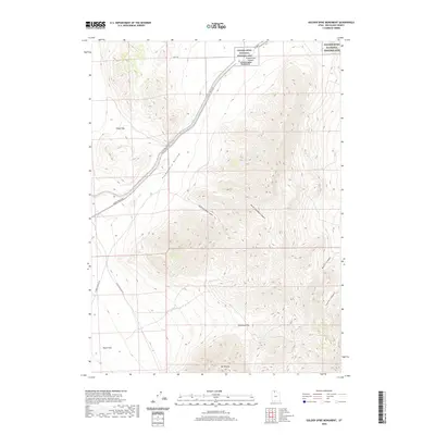
2020 Map of Golden Spike Monument
USGS Topo · Published 2020About this map
The Golden Spike National Historic Site Promontory Summit Golden Spike Monument serves as the focal point of this landscape in Box Elder County, marking the completion of the first transcontinental railroad. The terrain is characterized by a series of dramatic geographic features including Kings Pass and the broad expanse of Promontory Hollow. The movement of people through this area is traced by the Golden Spike Loop and various rural routes like N Big Valley Rd W.
Find a feature on this map
19 named features on this map. Tap any name to fly to it.
Don’t see what you’re looking for? This feature index may not catch every label — zoom into the map to look around manually.
Map Details
Editions of this 2020 Golden Spike Monument Map
This is the sole edition of this map. No revisions or reprints were ever made.
Other maps of this area

1954 · Brigham City
USGS Topo · 1:250,000

1958 · Brigham City
USGS Topo · 1:250,000

1961 · Thatcher Mountain
USGS Topo · 1:62,500

1962 · Brigham City
USGS Topo · 1:250,000

1966 · Thatcher Mountain SW
USGS Topo · 1:24,000

1967 · Golden Spike Monument
USGS Topo · 1:24,000

1967 · East Promontory
USGS Topo · 1:24,000

1968 · Messix Peak
USGS Topo · 1:24,000

1968 · Rozel
USGS Topo · 1:24,000

1968 · Lake Ridge
USGS Topo · 1:24,000