
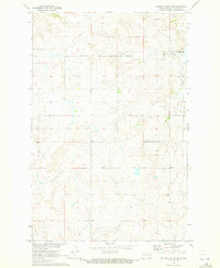
1970 Map of Golden Valley NW
USGS Topo · Published 1973About this map
The Fort Berthold Indian Reservation Boundary stretches across the northern portion of this Mercer County landscape, marking a significant cultural and administrative line in the Missouri River Basin. This 1970s topographical survey captures a sparsely populated region defined by the winding paths of Goodman Creek, Hans Creek, and Horse Creek, which carve through the high prairie. The isolation of the era is reflected in small, localized landmarks like Defiance Cem, which serves as a vital touchstone for genealogists and local historians tracking early families in this part of North Dakota. In addition to natural Spring water sources, a solitary Gravel Pit indicates the minor industrial activity required for maintaining the remote network of section lines and field boundaries that organize the terrain.
Find a feature on this map
8 named features on this map. Tap any name to fly to it.
Don’t see what you’re looking for? This feature index may not catch every label — zoom into the map to look around manually.
Map Details
Editions of this 1970 Golden Valley NW Map
This is the sole edition of this map. No revisions or reprints were ever made.
Other maps of this area

1953 · Watford City
USGS Topo · 1:250,000

1957 · Watford City
USGS Topo · 1:250,000

1967 · Watford City
USGS Topo · 1:250,000

1967 · Raub SE
USGS Topo · 1:24,000

1967 · Twin Buttes
USGS Topo · 1:24,000

1970 · Halliday NE
USGS Topo · 1:24,000

1970 · Hay Flat
USGS Topo · 1:24,000
1970 · Golden Valley NE
USGS Topo · 1:24,000

1973 · Halliday
USGS Topo · 1:24,000

1973 · Dodge
USGS Topo · 1:24,000