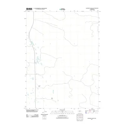
2011 Map of Goldman Lake SE
USGS Topo · Published 2011About this map
German Valley occupies a prominent position in this western Nebraska landscape, centered around a modest network of local routes like Co Rd-1-24 and Co Rd-3-24. The area is defined by its agricultural character and sparse settlement pattern, typical of the Sandhills region. A key landmark for local history and genealogy is the German Valley Cemetery, which serves as a primary record of the community's ancestral roots in Brown County. The terrain is marked by numerous small, unnamed water bodies and depressions that dot the prairie, illustrating the unique hydrology of the Nebraska interior during the early 21st century.
Find a feature on this map
4 named features on this map. Tap any name to fly to it.
Don’t see what you’re looking for? This feature index may not catch every label — zoom into the map to look around manually.
Map Details
Editions of this 2011 Goldman Lake SE Map
This is the sole edition of this map. No revisions or reprints were ever made.
Other maps of this area

1952 · Brewster
USGS Topo · 1:24,000

1952 · Almeria NW
USGS Topo · 1:24,000

1952 · Brewster NW
USGS Topo · 1:24,000

1955 · Broken Bow
USGS Topo · 1:250,000

1955 · O'Neill
USGS Topo · 1:250,000

1956 · Broken Bow
USGS Topo · 1:250,000

1959 · O'Neill
USGS Topo · 1:250,000

1969 · O'Neill
USGS Topo · 1:250,000

1981 · Boiling Spring
USGS Topo · 1:24,000

1981 · Paramount Valley
USGS Topo · 1:24,000