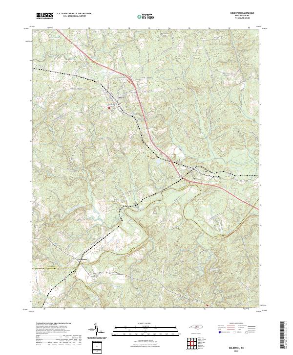
2022 Map of Goldston
USGS Topo · Published 2022About this map
The Deep River carves a winding path across this landscape, marking the tri-county border where Chatham, Lee, and Moore counties meet. The settlement of Goldston serves as a central hub, connected by a network of local roads such as Goldston Glendon Rd and Goldston Carbonton Rd that bridge the gaps between rural homesteads and agricultural tracts. Further south, the community of Carbonton sits near the riverbanks, an area defined by its proximity to the water and the historical transit routes like Alston House Rd.
Find a feature on this map
81 named features on this map. Tap any name to fly to it.
Don’t see what you’re looking for? This feature index may not catch every label — zoom into the map to look around manually.
Map Details
Editions of this 2022 Goldston Map
This is the sole edition of this map. No revisions or reprints were ever made.
Other maps of this area

1953 · Raleigh
USGS Topo · 1:250,000

1954 · Raleigh
USGS Topo · 1:250,000

1969 · Siler City
USGS Topo · 1:24,000

1970 · Goldston
USGS Topo · 1:24,000

1970 · Pittsboro
USGS Topo · 1:24,000

1970 · Colon
USGS Topo · 1:24,000

1970 · Bear Creek
USGS Topo · 1:24,000

1970 · Siler City NE
USGS Topo · 1:24,000

1974 · White Hill
USGS Topo · 1:24,000

1974 · Putnam
USGS Topo · 1:24,000