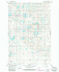
1958 Map of Goldwin SE
USGS Topo · Published 1986About this map
Cottonwood Lake and the surrounding wetland prairies of Stutsman County are documented here in a survey originally mapped during the late 1950s. The landscape is defined by the numerous basins of the National Waterfowl Production Area, showcasing a glaciated terrain of small kettles and larger bodies like Deer Lake and Brush Lake. The township-based rural organization of the mid-century is clearly visible, marked by a systematic network of numbered schools including School No 1 and School No 4 serving the scattered farmsteads of Paris and Spring Valley.
Find a feature on this map
19 named features on this map. Tap any name to fly to it.
Don’t see what you’re looking for? This feature index may not catch every label — zoom into the map to look around manually.
Map Details
Editions of this 1958 Goldwin SE Map
2 editions found
Other maps of this area

1896 · Jamestown
USGS Topo · 1:125,000

1900 · Pingree
USGS Topo · 1:125,000

1900 · Pingree
USGS Topo · 1:62,500

1951 · Pingree
USGS Topo · 1:24,000

1951 · Eldridge NW
USGS Topo · 1:24,000

1952 · Pingree SW
USGS Topo · 1:24,000

1952 · New Rockford
USGS Topo · 1:250,000

1953 · Jamestown
USGS Topo · 1:250,000

1953 · Cleveland
USGS Topo · 1:24,000

1954 · Cleveland NW
USGS Topo · 1:24,000