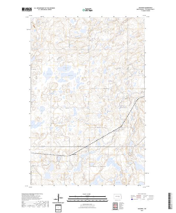
2024 Map of Goldwin
USGS Topo · Published 2024About this map
Goldwin stands as the central point of reference in this prairie landscape of central North Dakota, situated within a complex network of wetlands and conservation lands. The surrounding territory is defined by the extensive Stutsman County Waterfowl Production Area, which encompasses numerous glacial potholes and significant water bodies including Northwestern Lake, West Lake, Alkali Lake, and Eric Lake. These features indicate a terrain shaped by glacial recession, creating a habitat that remains vital for migratory bird populations.
Find a feature on this map
25 named features on this map. Tap any name to fly to it.
Don’t see what you’re looking for? This feature index may not catch every label — zoom into the map to look around manually.
Map Details
Editions of this 2024 Goldwin Map
This is the sole edition of this map. No revisions or reprints were ever made.
Other maps of this area

1948 · Carrington
USGS Topo · 1:62,500

1950 · Melville
USGS Topo · 1:24,000

1950 · Carrington SW
USGS Topo · 1:24,000

1952 · New Rockford
USGS Topo · 1:250,000

1956 · New Rockford
USGS Topo · 1:250,000
1958 · Vashti
USGS Topo · 1:24,000
1958 · Goldwin SE
USGS Topo · 1:24,000
1958 · Goldwin SW
USGS Topo · 1:24,000

1958 · Goldwin
USGS Topo · 1:24,000

1971 · New Rockford
USGS Topo · 1:250,000