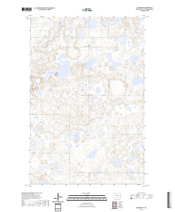
2024 Map of Goldwin SW
USGS Topo · Published 2024About this map
Glacial prairie potholes and protected wetlands dominate this portion of North Dakota, where the Stutsman County Waterfowl Production Area spans several disparate tracts of land. These conservation areas surround local water bodies including Eric Lake, Fischer Lake, and Spring Lake, creating a landscape defined by seasonal water levels and conservation management. For those researching local history or genealogy, the Reformed Cem stands as a significant point of interest near the center of the survey. The rectangular grid of rural roads, such as Co Hwy 67 and Co Hwy 42, provides the primary structure for this agricultural region, connecting the scattered sections of the waterfowl production zones across the township boundaries of T142N and T141N.
Find a feature on this map
19 named features on this map. Tap any name to fly to it.
Don’t see what you’re looking for? This feature index may not catch every label — zoom into the map to look around manually.
Map Details
Editions of this 2024 Goldwin SW Map
This is the sole edition of this map. No revisions or reprints were ever made.
Other maps of this area

1952 · New Rockford
USGS Topo · 1:250,000

1953 · Jamestown
USGS Topo · 1:250,000

1953 · Cleveland
USGS Topo · 1:24,000

1954 · Cleveland NW
USGS Topo · 1:24,000

1954 · Medina
USGS Topo · 1:24,000

1956 · New Rockford
USGS Topo · 1:250,000

1956 · Jamestown
USGS Topo · 1:250,000
1958 · Vashti
USGS Topo · 1:24,000
1958 · Goldwin SE
USGS Topo · 1:24,000
1958 · Goldwin SW
USGS Topo · 1:24,000