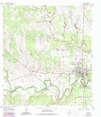
1962 Map of Goliad
USGS Topo · Published 1987About this map
Goliad sits at a strategic bend in the San Antonio River, serving as a focal point for Texas frontier history. The landscape is defined by its deep colonial roots, notably the Mission Nuestra Señora del Rosario to the west and the Presidio La Bahia to the southeast, marking the intersection of Spanish mission life and military defense. The town's religious and community life is reflected in landmarks like Zion Hill Ch and several burial grounds including Lott Cem and Glendale Cem. North of the river, the terrain rises into the Post Oak Hollow and is dissected by Manahuilla Creek, while the southern reaches near Goliad State Park show the integration of preservation and civic pride at the Memorial Shaft. The map records an era of gradual change where cattle and oil interests, indicated by numerous Gas Wells and Quarries, overlap with these enduring historical sites.
Find a feature on this map
29 named features on this map. Tap any name to fly to it.
Don’t see what you’re looking for? This feature index may not catch every label — zoom into the map to look around manually.
Map Details
Editions of this 1962 Goliad Map
Other maps of this area

1953 · Beeville
USGS Topo · 1:250,000

1956 · Beeville
USGS Topo · 1:250,000

1960 · Beeville
USGS Topo · 1:250,000

1962 · Live Oak Lake
USGS Topo · 1:24,000

1962 · Melo
USGS Topo · 1:24,000

1962 · Hensley Lake
USGS Topo · 1:24,000

1962 · Goliad
USGS Topo · 1:24,000

1963 · Weesatche
USGS Topo · 1:24,000

1963 · Berclair
USGS Topo · 1:24,000
1963 · Runge SE
USGS Topo · 1:24,000