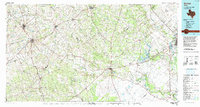
1985 Map of Goliad
USGS Topo · Published 1992About this map
The San Antonio River and Guadalupe River carve prominent paths across this South Texas landscape, anchoring a network of historic settlements and transportation routes. Historic preservation and military activity coexist here, evidenced by the proximity of Goliad State Park and the OLF Goliad (US Navy) airfield. The map documents the sprawling agricultural and ranching territory between the regional hubs of Kenedy and Victoria, featuring a dense web of smaller communities such as Upper Meyersville, Aneckeville, and Angel City.
Find a feature on this map
92 named features on this map. Tap any name to fly to it.
Don’t see what you’re looking for? This feature index may not catch every label — zoom into the map to look around manually.
Map Details
Editions of this 1985 Goliad Map
This is the sole edition of this map. No revisions or reprints were ever made.
Other maps of this area

1920 · Smiley
USGS Topo · 1:125,000

1920 · Mikeska
USGS Topo · 1:125,000

1925 · Tordia No. 1
USGS Topo · 1:48,000

1927 · Oakville
USGS Topo · 1:62,500

1931 · Falls City
USGS Topo · 1:62,500

1936 · Pettus
USGS Topo · 1:62,500

1936 · Floresville
USGS Topo · 1:62,500

1951 · Bloomington
USGS Topo · 1:24,000

1951 · Inez NW
USGS Topo · 1:24,000

1952 · Tivoli
USGS Topo · 1:24,000