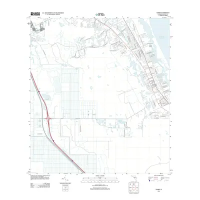
2012 Map of Gomez
USGS Topo · Published 2012About this map
The coastal community of Gomez and the residential developments of Poinciana Gardens characterize this stretch of the Florida coast as it appeared in the early 21st century. Situated along the South Jupiter Narrows and the Atlantic Ocean, the landscape is a complex network of waterways, featuring Peck Lake and the interior Banner Lake. The map illustrates a highly developed suburban layout, particularly around Hope Sound Bible College, where a dense grid of streets like SE Gomez Ave and SE Osprey St meet the shoreline. To the west, the terrain transitions into a more structured agricultural or drainage pattern near the S Fork Saint Lucie River, while Corset Island sits as a prominent landform within the coastal sounds. This survey captures the region's balance between residential expansion and its tidal environment.
Find a feature on this map
75 named features on this map. Tap any name to fly to it.
Don’t see what you’re looking for? This feature index may not catch every label — zoom into the map to look around manually.
Map Details
Editions of this 2012 Gomez Map
This is the sole edition of this map. No revisions or reprints were ever made.
Other maps of this area

1948 · Palm City
USGS Topo · 1:24,000

1948 · Rood
USGS Topo · 1:24,000

1948 · St. Lucie Inlet
USGS Topo · 1:24,000

1948 · Gomez
USGS Topo · 1:24,000

1948 · Hobe Sound
USGS Topo · 1:24,000

1948 · Jupiter
USGS Topo · 1:24,000

1949 · Rood
USGS Topo · 1:24,000

1949 · Gomez
USGS Topo · 1:24,000

1949 · Hobe Sound
USGS Topo · 1:24,000

1950 · St. Lucie Inlet
USGS Topo · 1:24,000