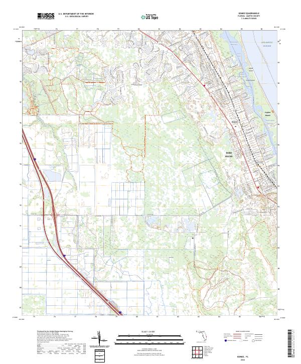
2024 Map of Gomez
USGS Topo · Published 2024About this map
Gomez and the surrounding coastal environment of Martin County are defined by a complex network of waterways and protected conservation lands. The Intracoastal Waterway separates the mainland from Jupiter Island and Corset Island, passing through Peck Lake and the Indian River Lagoon. This 2024 survey captures the modern interface of residential development and ecological preservation, with the Hobe Sound National Wildlife Refuge and Atlantic Ridge Preserve State Park Trl buffering the urban footprint of Hobe Sound. To the west, the South Fork Saint Lucie River meanders through low-lying wetlands, while the corridor is unified by long-distance paths such as the Florida East Coast Greenway - Martin Corridor Trl. Institutional landmarks, including the Hobe Sound Bible College, stand near the coastal ridge, illustrating the settlement's established community roots alongside significant recreational and natural resources like the Jonathan Dickinson State Park Trl.
Find a feature on this map
123 named features on this map. Tap any name to fly to it.
Don’t see what you’re looking for? This feature index may not catch every label — zoom into the map to look around manually.
Map Details
Editions of this 2024 Gomez Map
This is the sole edition of this map. No revisions or reprints were ever made.
Other maps of this area

1948 · Palm City
USGS Topo · 1:24,000

1948 · Rood
USGS Topo · 1:24,000

1948 · St. Lucie Inlet
USGS Topo · 1:24,000

1948 · Gomez
USGS Topo · 1:24,000

1948 · Hobe Sound
USGS Topo · 1:24,000

1948 · Jupiter
USGS Topo · 1:24,000

1949 · Rood
USGS Topo · 1:24,000

1949 · Gomez
USGS Topo · 1:24,000

1949 · Hobe Sound
USGS Topo · 1:24,000

1950 · St. Lucie Inlet
USGS Topo · 1:24,000