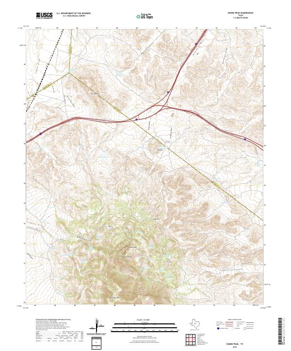
2022 Map of Gomez Peak
USGS Topo · Published 2022About this map
Gomez Peak and the surrounding high country of Woulfter Mtn define this section of West Texas where Culberson, Reeves, and Jeff Davis counties meet. The landscape is a network of arid drainage systems, including Harwell Draw, Ninemile Draw, and Bankhead Draw, which cut through the high-elevation terrain. Settlement in this region is defined by remote ranching operations, marked by the presence of Woulfter Ranch Rd and Nelson Letsco Ranch Rd. Water is the most critical resource here, evidenced by numerous named springs such as San Martine Spring, Indian Springs, and the Lower Hidden Spring. These water sources and artificial catchments like Canyon Mill Tank and Wallace Tank reveal the historical infrastructure required to sustain livestock in the Chihuahuan Desert highlands. The prominent elevations of Newman Peak and Gold Hill provide significant landmarks across this sparse, high-altitude terrain.
Find a feature on this map
59 named features on this map. Tap any name to fly to it.
Don’t see what you’re looking for? This feature index may not catch every label — zoom into the map to look around manually.
Map Details
Editions of this 2022 Gomez Peak Map
This is the sole edition of this map. No revisions or reprints were ever made.
Other maps of this area

1894 · Valentine
USGS Topo · 1:125,000

1894 · Fort Davis
USGS Topo · 1:125,000

1897 · Valentine
USGS Topo · 1:125,000

1897 · Fort Davis
USGS Topo · 1:125,000

1921 · Toyah
USGS Topo · 1:125,000

1928 · Kent
USGS Topo · 1:125,000

1943 · Valentine
USGS Topo · 1:125,000

1954 · Van Horn
USGS Topo · 1:250,000

1954 · Pecos
USGS Topo · 1:250,000

1954 · Fort Stockton
USGS Topo · 1:250,000