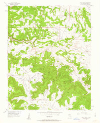
1954 Map of Gomez Ranch
USGS Topo · Published 1963About this map
Gomez Ranch and the San Juan Camp anchor this mid-century look at the Rio Arriba highlands, where the local economy was shifting from traditional ranching toward energy development. The landscape is defined by the winding paths of La Jara Creek and Frances Creek, which carve deep through La Jara Canyon and La Fragua Canyon. While a solitary Cem and Windmill indicate the persistence of early settlement and livestock raising, the proliferation of numerous Gas Well sites and an extensive network of Pipeline corridors signify the arrival of the modern oil and gas industry. A remote Landing Strip near the center of the sheet further illustrates the logistical efforts required to support these industrial operations in a territory traditionally dominated by isolated homesteads and rugged drainages.
Find a feature on this map
11 named features on this map. Tap any name to fly to it.
Don’t see what you’re looking for? This feature index may not catch every label — zoom into the map to look around manually.
Map Details
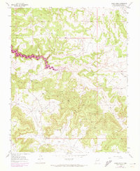
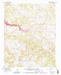
Editions of this 1954 Gomez Ranch Map
4 editions found
Other maps of this area

1889 · Largo
USGS Topo · 1:250,000

1895 · Largo
USGS Topo · 1:250,000

1954 · Pine River
USGS Topo · 1:24,000
1954 · Burnt Mesa
USGS Topo · 1:24,000

1954 · Rosa
USGS Topo · 1:24,000

1954 · Gomez Ranch
USGS Topo · 1:24,000

1954 · Aztec
USGS Topo · 1:250,000

1958 · Aztec
USGS Topo · 1:250,000

1959 · Gould Pass
USGS Topo · 1:62,500

1959 · Navajo Dam
USGS Topo · 1:62,500