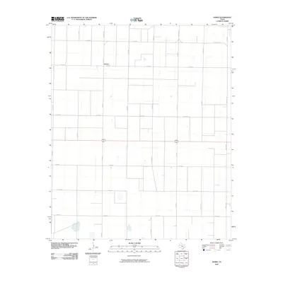
2010 Map of Gomez
USGS Topo · Published 2010About this map
Johnson sits at the intersection of Fm 402 N and Co Rd 410, serving as a primary landmark in this rural South Plains landscape of Terry County. The terrain is characterized by a high-density grid of agricultural roads, such as Co Rd 175 and Co Rd 195, which partition the territory into large, uniform sections typical of West Texas ranching and farming operations. This 2010 survey illustrates the organized spatial planning of the Llano Estacado, where transport is dominated by a systematic network of county roads and state-maintained routes like Ranch Rd 3287. The presence of several small depressions and scattered water features across the grid highlights the subtle drainage patterns of this semi-arid region, while the prominent east-west corridor of US 380/82 links these agricultural communities to larger regional hubs.
Find a feature on this map
18 named features on this map. Tap any name to fly to it.
Don’t see what you’re looking for? This feature index may not catch every label — zoom into the map to look around manually.
Map Details
Editions of this 2010 Gomez Map
This is the sole edition of this map. No revisions or reprints were ever made.
Other maps of this area

1954 · Brownfield
USGS Topo · 1:250,000

1958 · Brownfield
USGS Topo · 1:250,000

1962 · Brownfield
USGS Topo · 1:250,000

1969 · Gomez
USGS Topo · 1:24,000

1969 · Plains 1 SE
USGS Topo · 1:24,000

1969 · Foster
USGS Topo · 1:24,000

1969 · Sundown SE
USGS Topo · 1:24,000

1969 · Pool
USGS Topo · 1:24,000

1969 · Wellman
USGS Topo · 1:24,000
1969 · Brownfield West
USGS Topo · 1:24,000