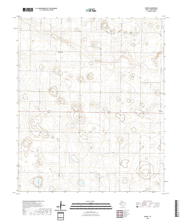
2022 Map of Gomez
USGS Topo · Published 2022About this map
Gomez and the surrounding Terry County landscape are defined by a high-plains topography where agriculture and a grid of rural roads predominate. In this region of West Texas, the ephemeral drainage of Lost Draw meanders across the northern portion of the sheet, providing a rare natural break in the otherwise steady elevation. The small settlement of Johnson sits along the northern edge, connected to the larger region by a network of ranch-to-market roads and the primary east-west corridor of US Hwy 380. The layout of the roads, including FM 402 and numerous county lines like Co Rd 410, reflects the systematic land partitioning common in this part of the Llano Estacado. Researchers of family history in this area will find the specific intersections and ranch roads, such as Ranch Rd 3262, useful for identifying original homesteads and field boundaries that have persisted into the twenty-first century.
Find a feature on this map
21 named features on this map. Tap any name to fly to it.
Don’t see what you’re looking for? This feature index may not catch every label — zoom into the map to look around manually.
Map Details
Editions of this 2022 Gomez Map
This is the sole edition of this map. No revisions or reprints were ever made.
Other maps of this area

1954 · Brownfield
USGS Topo · 1:250,000

1958 · Brownfield
USGS Topo · 1:250,000

1962 · Brownfield
USGS Topo · 1:250,000

1969 · Gomez
USGS Topo · 1:24,000

1969 · Plains 1 SE
USGS Topo · 1:24,000

1969 · Foster
USGS Topo · 1:24,000

1969 · Sundown SE
USGS Topo · 1:24,000

1969 · Pool
USGS Topo · 1:24,000

1969 · Wellman
USGS Topo · 1:24,000
1969 · Brownfield West
USGS Topo · 1:24,000