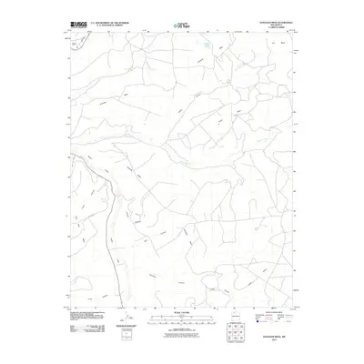
2010 Map of Gonzales Mesa
USGS Topo · Published 2010About this map
Gonzales Mesa and the surrounding high plateau country of Rio Arriba County are defined by a complex network of canyons and flat-topped mesas. In the northern reaches, Kaime Ranch represents a rare point of human settlement amidst the sprawling drainage systems of Ice Canyon and Albert Canyon. The landscape is carved by significant ephemeral waterways, most notably Cañon Largo and its various tributaries like Tapicito Creek and Forbes Canyon. This 2010 survey illustrates the remote infrastructure of the region, anchored by CO Road 523 and various unpaved routes that navigate between Encinada Mesa and Carter Mesa. The southeastern portion of the map transitions into Lapis Valley and Lapis Canyon, providing a clear look at the geological transitions between the mesa tops and the canyon floors.
Find a feature on this map
20 named features on this map. Tap any name to fly to it.
Don’t see what you’re looking for? This feature index may not catch every label — zoom into the map to look around manually.
Map Details
Editions of this 2010 Gonzales Mesa Map
This is the sole edition of this map. No revisions or reprints were ever made.
Other maps of this area

1889 · Largo
USGS Topo · 1:250,000

1895 · Largo
USGS Topo · 1:250,000

1954 · Aztec
USGS Topo · 1:250,000

1958 · Aztec
USGS Topo · 1:250,000

1959 · Gould Pass
USGS Topo · 1:62,500

1959 · Nageezi
USGS Topo · 1:62,500

1962 · Aztec
USGS Topo · 1:250,000

1963 · Lapis Point
USGS Topo · 1:24,000

1963 · Tayfoya Canyon
USGS Topo · 1:24,000

1963 · Gonzales Mesa
USGS Topo · 1:24,000