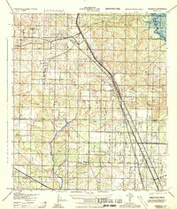
1944 Map of Gonzalez
USGS Topo · Published 1944About this map
The Louisville & Nashville Railroad and the Frisco Line intersect at Cantonment, defining the industrial and transportation corridor of this inland Escambia County region during the mid-1940s. The landscape is marked by a transition from the structured settlement patterns around Gonzalez and Ensley to the riverine geography of the Brosnaham Island area along the northeastern edge. Aviation infrastructure is prominent with the Tallahassee Landing Field and an additional Landing Field, reflecting the military and logistical importance of the area during the war years.
Find a feature on this map
28 named features on this map. Tap any name to fly to it.
Don’t see what you’re looking for? This feature index may not catch every label — zoom into the map to look around manually.
Map Details
Editions of this 1944 Gonzalez Map
This is the sole edition of this map. No revisions or reprints were ever made.
Other maps of this area

1920 · Milton
USGS Topo · 1:62,500

1921 · Pensacola
USGS Topo · 1:62,500

1921 · Fort Barrancas
USGS Topo · 1:62,500

1921 · Muscogee
USGS Topo · 1:62,500

1941 · Fort Barrancas
USGS Topo · 1:62,500

1941 · Muscogee
USGS Topo · 1:62,500

1941 · Pensacola
USGS Topo · 1:62,500

1941 · Milton
USGS Topo · 1:62,500

1942 · Pensacola
USGS Topo · 1:62,500

1943 · Muscogee
USGS Topo · 1:62,500