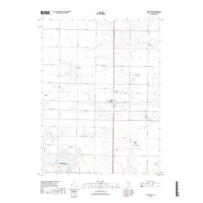
2018 Map of Good Hope
USGS Topo · Published 2018About this map
Good Hope and Sciota anchor this rural landscape in western Illinois, where the agricultural grid is deeply carved by the drainage of the E Fork La Moine River. The terrain is defined by a series of branching waterways, including Farmers Fork, Town Fork, and Short Fork, which create localized relief against the surrounding farm fields. Near the southern edge of the quadrangle, the northern outskirts of Macomb appear, featuring the Macomb Municipal Airport and the recreational waters of Spring Lake. Local heritage is preserved in several rural burial grounds such as Hickory Grove Cem, Good Hope Cem, and Walnut Grove Cem, which serve as important landmarks for genealogical research. The network of county roads, such as Co HWY 5, connects these small communities and isolated cemeteries, illustrating the enduring settlement patterns of McDonough County.
Find a feature on this map
39 named features on this map. Tap any name to fly to it.
Don’t see what you’re looking for? This feature index may not catch every label — zoom into the map to look around manually.
Map Details
Editions of this 2018 Good Hope Map
This is the sole edition of this map. No revisions or reprints were ever made.
Other maps of this area

1912 · Macomb
USGS Topo · 1:62,500

1913 · Colchester
USGS Topo · 1:62,500

1914 · Macomb
USGS Topo · 1:62,500

1916 · Good Hope
USGS Topo · 1:62,500

1918 · La Harpe
USGS Topo · 1:62,500

1918 · Good Hope
USGS Topo · 1:62,500

1958 · Burlington
USGS Topo · 1:250,000

1961 · Burlington
USGS Topo · 1:250,000

1963 · Burlington
USGS Topo · 1:250,000
1974 · Bardolph
USGS Topo · 1:24,000