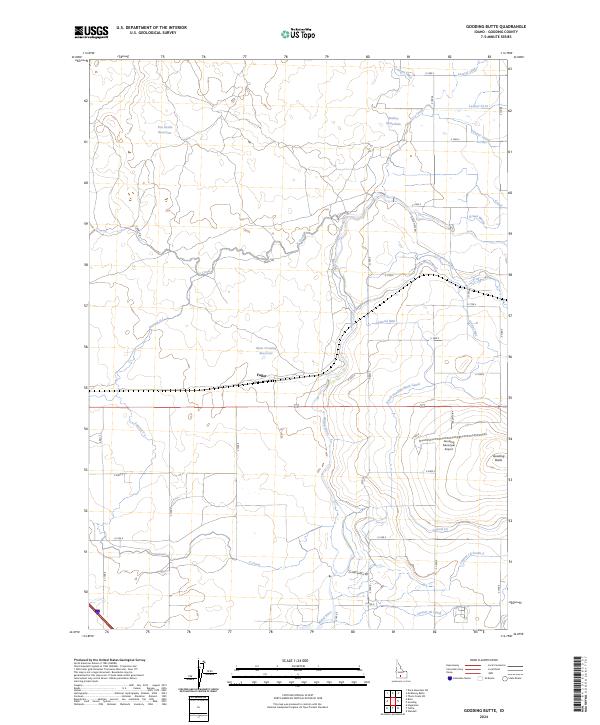
2024 Map of Gooding Butte
USGS Topo · Published 2024About this map
Big Wood River and Little Wood River converge in this high-desert landscape, creating a complex hydrologic network critical to local agriculture. The terrain is defined by the prominent volcanic profile of Gooding Butte and the extensive irrigation infrastructure that supports the region, including the South Gooding Main Canal, Z Canal, and Carpenter Ditch. This 2024 survey documents the modern layout of rural settlements like Fuller and the aviation hub at Gooding Municipal Airport.
Find a feature on this map
45 named features on this map. Tap any name to fly to it.
Don’t see what you’re looking for? This feature index may not catch every label — zoom into the map to look around manually.
Map Details
Editions of this 2024 Gooding Butte Map
This is the sole edition of this map. No revisions or reprints were ever made.
Other maps of this area

1949 · Bliss
USGS Topo · 1:24,000

1949 · Gooding Butte
USGS Topo · 1:24,000

1949 · Tuttle
USGS Topo · 1:24,000

1949 · Hagerman
USGS Topo · 1:24,000

1950 · Gooding Butte
USGS Topo · 1:24,000

1950 · Hagerman
USGS Topo · 1:24,000

1950 · Bliss
USGS Topo · 1:24,000

1951 · Tuttle
USGS Topo · 1:24,000

1955 · Twin Falls
USGS Topo · 1:250,000

1955 · Hailey
USGS Topo · 1:250,000