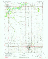
1962 Map of Goodland
USGS Topo · Published 1976About this map
Goodland anchors the southern portion of this mid-century survey, situated at the intersection of a sprawling rural road network and the Pennsylvania railroad line. The landscape reflects the highly engineered agricultural nature of northwestern Indiana, defined by an intricate system of drainage canals such as Barten Ditch, Moran Ditch, and Hunter Ditch. These waterways manage the low-lying terrain surrounding the Iroquois River, which meanders through the northern section past the Hazelden Country Club and Ade Hospital. To the north, the town of Brook sits near Riverside Lake, while smaller rail-related sites like Percy Junction and Foresman dot the plains. For genealogists, the map is particularly useful for locating rural burial sites, including Foster Cem, Goodland Cem, and Mt Calvary Cem, which are clearly marked along the section lines and county boundaries.
Find a feature on this map
47 named features on this map. Tap any name to fly to it.
Don’t see what you’re looking for? This feature index may not catch every label — zoom into the map to look around manually.
Map Details
Editions of this 1962 Goodland Map
2 editions found
Other maps of this area

1953 · Danville
USGS Topo · 1:250,000

1955 · Danville
USGS Topo · 1:250,000

1956 · Danville
USGS Topo · 1:250,000

1961 · Kentland
USGS Topo · 1:24,000

1961 · Mount Ayr
USGS Topo · 1:24,000

1961 · Morocco
USGS Topo · 1:24,000

1962 · Mount Gilboa
USGS Topo · 1:24,000

1962 · Wadena
USGS Topo · 1:24,000

1962 · Goodland
USGS Topo · 1:24,000

1962 · Earl Park
USGS Topo · 1:24,000