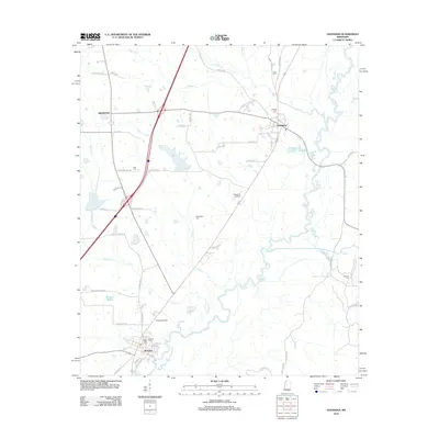
2012 Map of Goodman
USGS Topo · Published 2012About this map
Pickens and Goodman anchor this Mississippi landscape, positioned along the historic transport corridor between the Big Black River and the uplands to the north. In the early 21st century, the map reveals a community defined by its proximity to the winding river system and several small-scale airfields, including Presleys Airport and Peterson Airport. The town of Pickens is particularly detailed, showing a grid of residential streets such as Peace St and Madison St near the banks of the river.
Find a feature on this map
65 named features on this map. Tap any name to fly to it.
Don’t see what you’re looking for? This feature index may not catch every label — zoom into the map to look around manually.
Map Details
Editions of this 2012 Goodman Map
This is the sole edition of this map. No revisions or reprints were ever made.
Other maps of this area

1940 · Lexington
USGS Topo · 1:62,500

1953 · Meridian
USGS Topo · 1:250,000

1953 · Greenwood
USGS Topo · 1:250,000

1953 · West Point
USGS Topo · 1:250,000

1955 · Jackson
USGS Topo · 1:250,000

1956 · Greenwood
USGS Topo · 1:250,000

1957 · Meridian
USGS Topo · 1:250,000

1957 · Lexington
USGS Topo · 1:62,500

1958 · West Point
USGS Topo · 1:250,000

1958 · Lexington
USGS Topo · 1:62,500