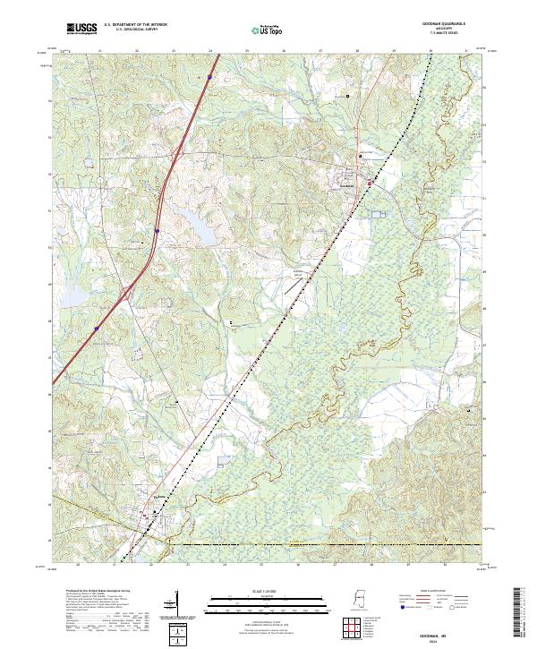
2024 Map of Goodman
USGS Topo · Published 2024About this map
The town of Goodman and its academic anchor, Holmes Community College, define the northern landscape of this central Mississippi region. Positioned along a primary north-south transportation corridor, the area transitions from the settled streets of Pickens in the south to the meandering wetlands of the Big Black River. This waterway forms a complex boundary and drainage system, joined by tributaries such as Box Creek and Seneasha Creek, creating a landscape defined by alluvial plains and small bayous like Bisland Bayou.
Find a feature on this map
53 named features on this map. Tap any name to fly to it.
Don’t see what you’re looking for? This feature index may not catch every label — zoom into the map to look around manually.
Map Details
Editions of this 2024 Goodman Map
This is the sole edition of this map. No revisions or reprints were ever made.
Other maps of this area

1940 · Lexington
USGS Topo · 1:62,500

1953 · Meridian
USGS Topo · 1:250,000

1953 · Greenwood
USGS Topo · 1:250,000

1953 · West Point
USGS Topo · 1:250,000

1955 · Jackson
USGS Topo · 1:250,000

1956 · Greenwood
USGS Topo · 1:250,000

1957 · Meridian
USGS Topo · 1:250,000

1957 · Lexington
USGS Topo · 1:62,500

1958 · West Point
USGS Topo · 1:250,000

1958 · Lexington
USGS Topo · 1:62,500