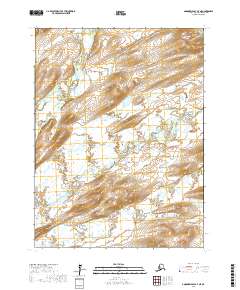
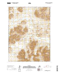
2017 Map of Goodnews Bay A-7 NE
USGS Topo · Published 2017About this map
Goodnews River defines the drainage patterns of this Alaskan landscape, where braided waterways move through the Bethel Census Area. The map captures the convergence of major branches, including the Middle Fork Goodnews River and the S Fork Goodnews River, which weave through terrain marked by extensive wetland systems and gradual elevation changes. Rising above the low-lying river valleys, Lookout Mtn provides a clear landmark in the southern portion of the quadrangle. Smaller tributaries like Tivyagak Cr feed into the larger river network, illustrating the complex hydrology of this subarctic environment. The lack of road infrastructure or established settlements emphasizes the wilderness character of the region, where land navigation relies almost entirely on following the intricate bends of these primary watercourses and the relief of named summits.
Find a feature on this map
9 named features on this map. Tap any name to fly to it.
Don’t see what you’re looking for? This feature index may not catch every label — zoom into the map to look around manually.
Map Details
Editions of this 2017 Goodnews Bay A-7 NE Map
This is the sole edition of this map. No revisions or reprints were ever made.
Other maps of this area

1951 · Goodnews
USGS Topo · 1:250,000

1954 · Goodnews B-7
USGS Topo · 1:63,360

1954 · Goodnews A-7
USGS Topo · 1:63,360

1954 · Goodnews A-6
USGS Topo · 1:63,360

1954 · Goodnews B-6
USGS Topo · 1:63,360

1979 · Goodnews Bay
USGS Topo · 1:250,000
2017 · Goodnews Bay A-7 SW
USGS Topo · 1:25,000
2017 · Goodnews Bay A-6 SW
USGS Topo · 1:25,000
2017 · Goodnews Bay A-6 NW
USGS Topo · 1:25,000
2017 · Goodnews Bay B-7 SW
USGS Topo · 1:25,000