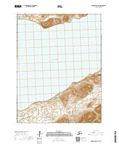
2017 Map of Goodnews Bay A-8 SE
USGS Topo · Published 2017About this map
Platinum occupies the southwestern corner of this coastal landscape, serving as a hub for the remote mining interests of the Bethel region. The settlement is connected to the interior via Red Mountain Road, which skirts the tidal flats and marshes of the Smalls River. To the north, the waters of Goodnews Bay open into the Pacific Ocean, framed by the prominent elevation of Beluga Hill. The terrain is characterized by complex hydrology, where Tundra Cr winds through saturated lowlands before meeting the bay. This 2017 survey captures the intersection of industrial access and the untamed Alaskan coastline, documenting the precise township and range boundaries such as t13s r75w that define property and mineral claims in this isolated part of the state.
Find a feature on this map
10 named features on this map. Tap any name to fly to it.
Don’t see what you’re looking for? This feature index may not catch every label — zoom into the map to look around manually.
Map Details
Editions of this 2017 Goodnews Bay A-8 SE Map
This is the sole edition of this map. No revisions or reprints were ever made.
Other maps of this area

1950 · Hagemeister Island D-6
USGS Topo · 1:63,360

1950 · Hagemeister Island D-5
USGS Topo · 1:63,360

1951 · Goodnews
USGS Topo · 1:250,000

1951 · Hagemeister Island
USGS Topo · 1:250,000

1954 · Goodnews A-8
USGS Topo · 1:63,360

1954 · Goodnews A-7
USGS Topo · 1:63,360

1954 · Hagemeister Island D-5
USGS Topo · 1:63,360

1957 · Hagemeister Island
USGS Topo · 1:250,000

1979 · Goodnews Bay
USGS Topo · 1:250,000
2017 · Goodnews Bay A-7 SW
USGS Topo · 1:25,000