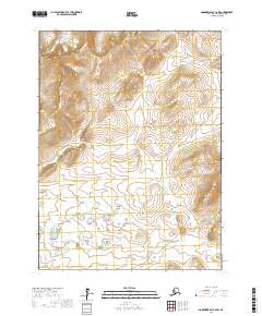
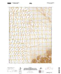
2017 Map of Goodnews Bay C-6 SW
USGS Topo · Published 2017About this map
The Ahklun Mountains dominate this high-latitude terrain within the Bethel Census Area of southwest Alaska. Steep elevations rise sharply from the drainage basins, with prominent peaks such as Thumb Mtn and Ingluilngok Mtn anchoring the northern and central portions of the quadrangle. The map reveals a complex hydraulic system typical of the region's subarctic environment, where small streams like Bessie Cr and Keno Cr carve narrow valleys through the upland ridges. In the southern lowlands, the character of the land shifts towards a dense network of small ponds and wetlands surrounding Flat Cr. This 2017 survey details a landscape primarily shaped by natural forces and topography rather than human settlement, preserving the original hydrological patterns of the Takshilik Cr watershed.
Find a feature on this map
13 named features on this map. Tap any name to fly to it.
Don’t see what you’re looking for? This feature index may not catch every label — zoom into the map to look around manually.
Map Details
Editions of this 2017 Goodnews Bay C-6 SW Map
This is the sole edition of this map. No revisions or reprints were ever made.
Other maps of this area

1951 · Goodnews
USGS Topo · 1:250,000

1954 · Goodnews B-7
USGS Topo · 1:63,360

1954 · Goodnews C-7
USGS Topo · 1:63,360

1954 · Goodnews B-6
USGS Topo · 1:63,360

1954 · Goodnews C-6
USGS Topo · 1:63,360

1979 · Goodnews Bay
USGS Topo · 1:250,000
2017 · Goodnews Bay B-7 NE
USGS Topo · 1:25,000
2017 · Goodnews Bay C-6 NW
USGS Topo · 1:25,000
2017 · Goodnews Bay B-6 NW
USGS Topo · 1:25,000
2017 · Goodnews Bay C-7 NE
USGS Topo · 1:25,000