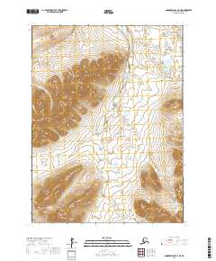
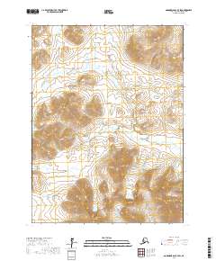
2017 Map of Goodnews Bay B-7 NE
USGS Topo · Published 2017About this map
The South Fork Arolik River cuts a prominent path through this corner of the Bethel Census Area, revealing a landscape defined by isolated peaks and a complex drainage network. Dominating the southern terrain is Tatlignagpeke Mtn, while Island Mtn stands as a distinct landmark further north. The map details an intricate web of seasonal and perennial streams, including Colorado Cr, Midas Cr, and Garnet Cr, which feed into the primary river system. This 2017 survey reflects the remote character of southwestern Alaska, where the absence of roads or permanent settlements emphasizes the dominance of natural topography and hydrography. The land is divided by the Public Land Survey System into townships such as t8s r71w and t9s r72w, providing a structured grid over the untamed river valleys and mountain slopes.
Find a feature on this map
16 named features on this map. Tap any name to fly to it.
Don’t see what you’re looking for? This feature index may not catch every label — zoom into the map to look around manually.
Map Details
Editions of this 2017 Goodnews Bay B-7 NE Map
This is the sole edition of this map. No revisions or reprints were ever made.
Other maps of this area

1951 · Goodnews
USGS Topo · 1:250,000

1954 · Goodnews B-7
USGS Topo · 1:63,360

1954 · Goodnews C-7
USGS Topo · 1:63,360

1954 · Goodnews B-6
USGS Topo · 1:63,360

1954 · Goodnews C-6
USGS Topo · 1:63,360

1979 · Goodnews Bay
USGS Topo · 1:250,000
2017 · Goodnews Bay B-7 NW
USGS Topo · 1:25,000
2017 · Goodnews Bay C-6 SW
USGS Topo · 1:25,000
2017 · Goodnews Bay B-6 NW
USGS Topo · 1:25,000
2017 · Goodnews Bay B-7 SW
USGS Topo · 1:25,000