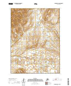
2020 Map of Goodnews Bay D-4 NE
USGS Topo · Published 2020About this map
The Kanektok River winds through the southern reaches of this landscape, its braided channels and oxbows indicating a highly dynamic river system within the Bethel Census Area. Further north, the Eek River and its tributary Rainy Cr define the drainage patterns of the upper terrain. The landscape is marked by significant elevation changes, with the western edge rising into prominent ridges while the central and southern portions are dominated by an intricate network of wetlands and small watercourses like Pailigut Cr and Tsadagluk Cr. This survey illustrates the transition from high-relief alpine environments to the water-saturated lowlands typical of this region of Alaska, documented during a period of modern topographic monitoring.
Find a feature on this map
9 named features on this map. Tap any name to fly to it.
Don’t see what you’re looking for? This feature index may not catch every label — zoom into the map to look around manually.
Map Details
Editions of this 2020 Goodnews Bay D-4 NE Map
This is the sole edition of this map. No revisions or reprints were ever made.
Other maps of this area

1950 · Bethel
USGS Topo · 1:250,000

1951 · Goodnews
USGS Topo · 1:250,000

1954 · Bethel A-4
USGS Topo · 1:63,360

1954 · Goodnews D-4
USGS Topo · 1:63,360

1979 · Bethel A-3
USGS Topo · 1:63,360

1979 · Goodnews Bay D-3
USGS Topo · 1:63,360

1979 · Goodnews Bay
USGS Topo · 1:250,000

1980 · Bethel
USGS Topo · 1:250,000
2017 · Bethel A-4 SE
USGS Topo · 1:25,000
2017 · Bethel A-4 SW
USGS Topo · 1:25,000