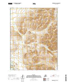
2020 Map of Goodnews Bay D-6 SE
USGS Topo · Published 2020About this map
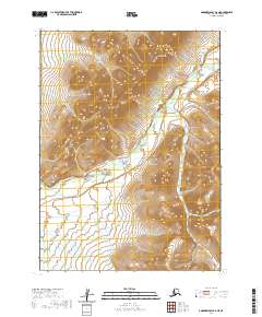
The Kanektok River and Ugalik River flow through this section of the Bethel Census Area, defining the topography of this southwestern Alaska landscape. This 2020 survey illustrates the high-latitude drainage patterns where these waterways carve through the terrain within the Public Land Survey System grids of t3s r68w, t4s r68w, and t5s r69w. The map focuses on the natural hydrology and elevation of the region, providing a detailed record of the river courses and their surrounding wetlands as they existed at the time of the SPOT imagery update in 2016. In the absence of roads or named settlements, the shifting channels of the Kanektok River remain the primary landmarks for navigating this remote territory.
Find a feature on this map
9 named features on this map. Tap any name to fly to it.
Don’t see what you’re looking for? This feature index may not catch every label — zoom into the map to look around manually.
Map Details
Editions of this 2020 Goodnews Bay D-6 SE Map
This is the sole edition of this map. No revisions or reprints were ever made.
Other maps of this area

1951 · Goodnews
USGS Topo · 1:250,000

1954 · Goodnews D-6
USGS Topo · 1:63,360

1954 · Goodnews D-5
USGS Topo · 1:63,360

1954 · Goodnews C-6
USGS Topo · 1:63,360

1979 · Goodnews Bay C-5
USGS Topo · 1:63,360

1979 · Goodnews Bay
USGS Topo · 1:250,000
2017 · Goodnews Bay C-6 NW
USGS Topo · 1:25,000
2017 · Goodnews Bay D-6 SW
USGS Topo · 1:25,000
2017 · Goodnews Bay D-6 NW
USGS Topo · 1:25,000
2020 · Goodnews Bay D-6 NE
USGS Topo · 1:25,000